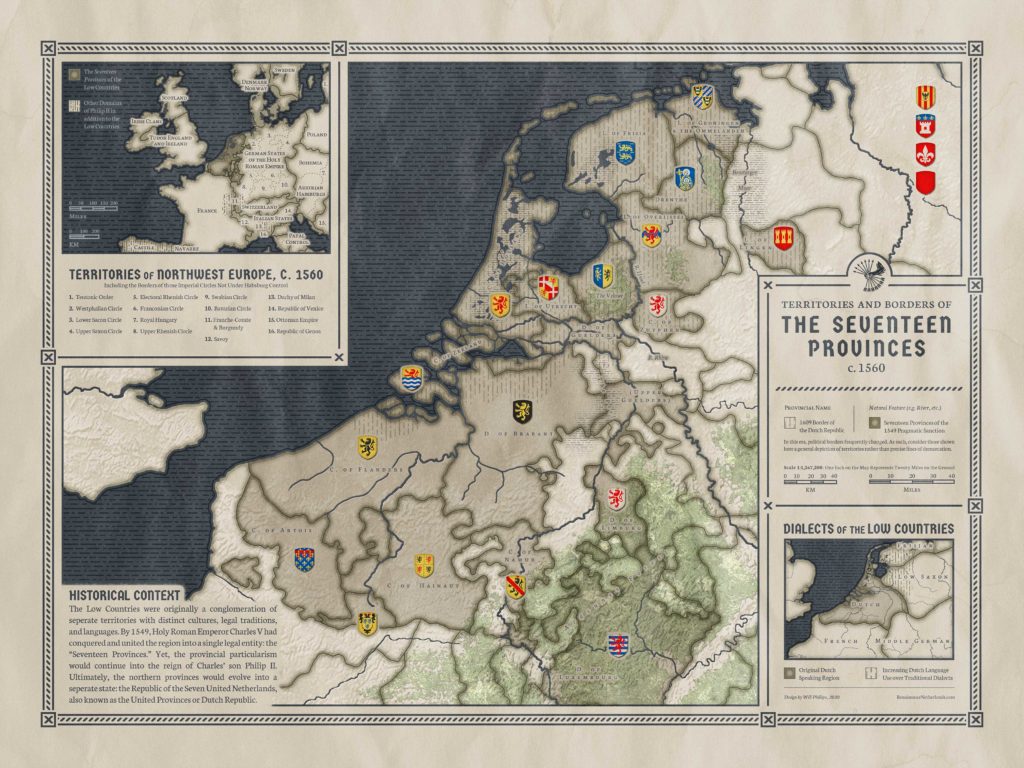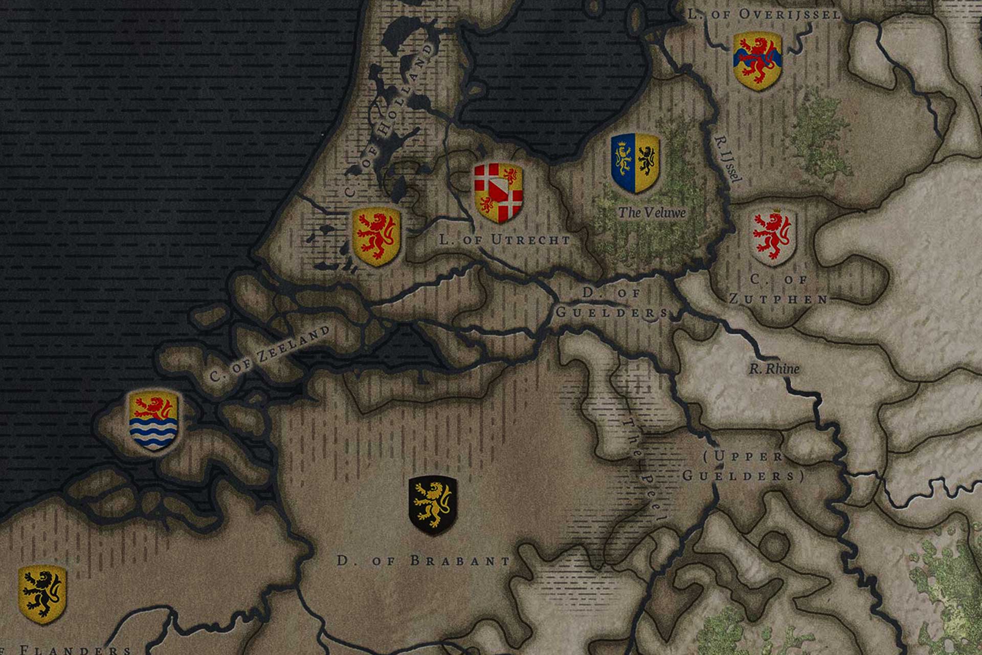
While much of the Low Countries were united as the “Seventeen Provinces,” some regions remained outside of Charles’ control, such as the ecclesiastical holdings of Liège, various territories under the control of German princes, and a smatter of smaller, independent holdings.
Add to that mix the fact that contemporaries – and historians today – are dividing on just which provinces made up the seventeen, and you get a complicated geography to decipher. Use the following map to identify provinces and major geographical landmarks.
This is a work in progress!